by Philippe Domogala
IFATCA Contributing EditorThe potential risks of interfering with satellite navigation systems (GNSS) have been well-researched and documented in recent years. IFATCA’s TOC is writing working papers on the subject, and large groups of aviation professionals have held meetings to discuss the issue and to try to find mitigations—unfortunately, without success so far.
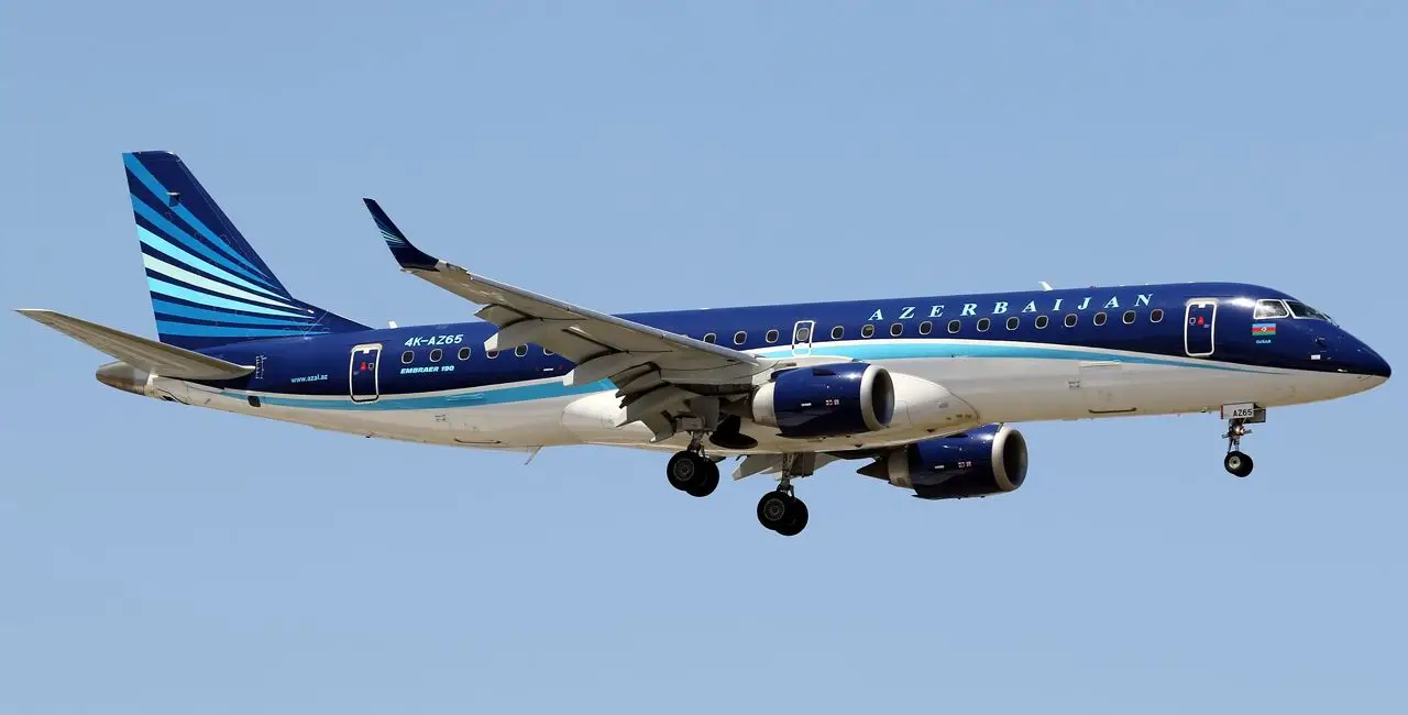
Civil aircraft currently rely on the Global Positioning System, GPS, as other constellations such as GLONASS and Galileo are not (yet) certified. GPS jamming and spoofing have become military warfare tools, and our civil infrastructure and airliners are not equipped to counter electronic warfare. At the end of 2024, GPS interference set in motion a series of events that resulted in the crash of an Azerbaijan Airlines Embraer E 190 inbound for Grozny, the capital city of Chechnya, Russia.

While the investigation is ongoing, information from Russian media, Flightradar24 and other sources (such as the leaked R/T transmissions between Grozny Tower ATC and the aircraft) are well aligned. On an IFR flight plan, the flight was scheduled as an international commercial flight between Baku, Azerbaijan, and Grozny. While the visibility in Grozny was reported marginal, and as there is no ILS at the airport, the flight began an RNP approach using GPS. The approach had to be discontinued when the GPS signal was suddenly lost. During the climb out, the crew reported what they initially believed had been a bird strike. After the aircraft suffered hydraulic failures and major flight control problems, it made it across the Caspian Sea before crash landing just short of the airport in Aktau, Kazakhstan. Over the following days, photos emerged showing apparent shrapnel damage to the tail and other parts of the aircraft. Of the 67 people on board, 38 did not survive the crash landing.
Days later, Russian authorities acknowledged they had been jamming GPS signals at that time, saying it was a reaction to a Ukrainian drone attack on the city. They eventually also admitted that anti-aircraft missiles were deployed to counter the attack. A Russian military spokesperson later said that the airspace around Grozny airspace was supposed to be closed. Still, that info did not reach civil ATC and/or the Embraer crew. Some media have speculated that the Russian missile system had been unable to correctly identify the civil aircraft as it was also affected by interference/jamming.
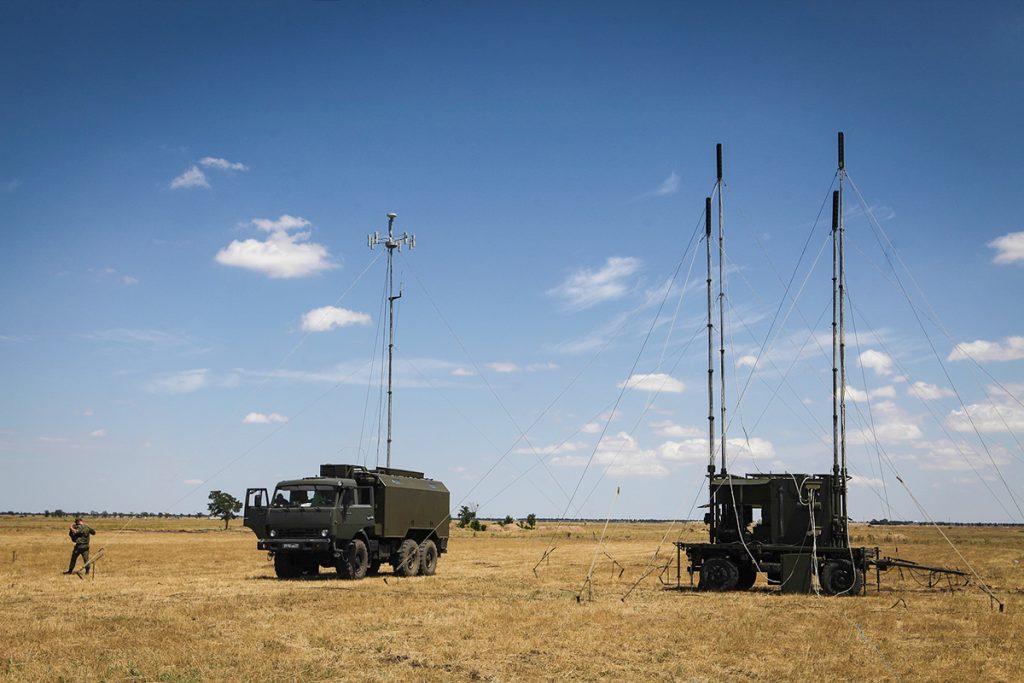
Without apportioning blame or trying to preempt the official investigation, it is worth stressing again the danger GNSS jamming causes for civil aviation and looking at how such jamming systems work indiscriminately. A well-known and mass-produced system is the R-330Zh Zhitel. This is a mobile communication jamming system mounted on a truck and manufactured in Russia. It is the standard equipment of the Russian Federation Army, and the first versions date back to the end of the 1990s.

The system consists of two elements: an operator cabin, mounted on top of an army truck, that houses the reconnaissance system and controls the jamming transmitters, and a trailer containing powerful transmitters and four telescopic antennas, i.e. the actual jamming system. According to the (publicly available) information, “the station can jam all communications and navigation systems[…] its purpose is to detect, track and jam the Inmarsat and Iridium communications satellite, GSM cellphones, and also to act against GPS navigation system satellites. It also can jam all VHF R/T communications“.
This Zhitel system covers frequencies from 100 MHz to 2 GHz, targeting military and civil communications and GNSS satellite signals. The jamming consists of powerful noise that suppresses or overwhelms the original signals.
This means the system can render nearly all civil navigation aids unusable, except for NDB. All VHF and UHF systems, including VOR, DME, ILS, voice, and datalink communications, are affected. It can also disrupt the signals from communication and navigation satellites (of all the various constellations, so not only GPS) and cell phone signals.
The Zhitel system is made for military use in conflict areas and has an effective range of around 20 Nm. It is primarily designed to protect troops and equipment against precision-guided munitions (PGMs) and drones. However, it will indiscriminately affect any civil aircraft, airport air traffic control communication, and navigation aids within its range. Besides this system, Russia, the U.S.A., NATO, and other military powers have access to more sophisticated and robust systems with an effective radius of hundreds of miles. For instance, the current jamming and spoofing around the Russian Kaliningrad enclave between Poland and Lithuania has a radius of more than 200Nm.
Together with the Flight Safety Foundation (FSF), IFATCA and IFALPA are involved in raising awareness and finding help in mitigating the effects of GNSS interference. One of the primary goals is to get the issue on the agenda of ICAO. At the same time, it seems likely that GNSS jamming and spoofing have become integral to (electronic) warfare. With current and future wars heavily relying on drones, which also use GNSS and satellite communication, it seems civil aviation will remain affected by military jamming and spoofing. For now, avoiding areas where GNSS interference occurs appears to be the only viable mitigation.


